

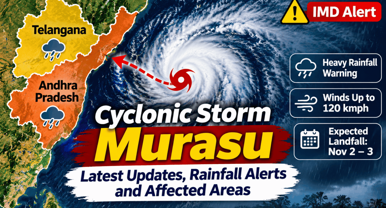
Cyclonic Storm Murasu is moving towards the Andhra Pradesh coast over the Bay of Bengal, with the India Meteorological Department (IMD) warning of extremely heavy rainfall, strong winds and possible disruption across parts of Andhra Pradesh, Telangana and neighbouring states. Coastal districts are facing the greatest immediate threat, while several districts in Telangana are also under rainfall alerts.
Last updated: November 2, 2026 | Based on IMD bulletins issued on November 1, 2026. Check the latest official advisories before travelling or making safety decisions.
Cyclonic Storm Murasu: Latest Update
Cyclonic Storm Murasu formed over the southwest and adjoining west-central Bay of Bengal after a weather system intensified over the sea. In its November 1 bulletin, the IMD said the storm was moving west-northwestwards and was expected to strengthen into a severe cyclonic storm.
The IMD forecast that Murasu could cross the south Andhra Pradesh coast between Nellore and Narsapur, close to Ongole, between late November 2 and the early hours of November 3.
At the time of the bulletin, the expected wind speed during landfall was 100–110 kmph, with gusts potentially reaching 120 kmph. These are forecast figures, not confirmation that landfall has occurred.
The storm’s movement and intensity may change. Residents should follow the latest IMD bulletins and district administration announcements.
Which Areas Could Be Affected by Cyclone Murasu?
Andhra Pradesh is expected to face the most direct impact from the approaching system. Heavy to extremely heavy rainfall is forecast in parts of the coastal region, with strong winds and rough sea conditions expected around the storm.
The IMD’s November 1 district warning information identified the following areas for attention.
Andhra Pradesh
Five districts were reported under a red rainfall warning for November 2:
- Nellore
- Prakasam
- Bapatla
- Guntur
- Krishna
The forecast also indicated the possibility of very heavy rainfall in parts of Rayalaseema. Residents in coastal and low-lying areas should follow evacuation instructions and local administration alerts.
Telangana
The Meteorological Centre, Hyderabad, issued rainfall alerts for several districts on November 2.
An orange alert was reported for isolated heavy rainfall in:
- Khammam
- Nalgonda
- Suryapet
- Mahabubnagar
- Nagarkurnool
- Wanaparthy
A yellow alert was reported for:
- Hyderabad
- Rangareddy
- Medchal-Malkajgiri
- Jangaon
- Yadadri Bhuvanagiri
Thunderstorms, lightning and gusty winds of around 30–40 kmph were also forecast at isolated places across several Telangana districts.
Tamil Nadu and Odisha
Parts of Tamil Nadu, including Chennai and neighbouring districts, were also expected to receive heavy rainfall. The forecast covered areas such as Tiruvallur, Chengalpattu and Kancheepuram.
Odisha was also expected to experience rainfall associated with the system, with the possibility of heavy to very heavy rainfall in southern districts on November 3 and 4.
These are forecast areas and dates from the available advisories. District-level warnings can change as the cyclone moves.
How Strong Could Cyclone Murasu Become?
According to the IMD forecast issued on November 1, Murasu was likely to intensify into a severe cyclonic storm before approaching the south Andhra Pradesh coast.
The forecast landfall wind speed was 100–110 kmph, with gusts reaching up to 120 kmph.
Such winds can damage weak structures, uproot trees, break branches and disrupt electricity and communication services. Heavy rainfall can also cause waterlogging, flash flooding and difficulties on roads.
The IMD’s forecast track placed the likely landfall area between Nellore and Narsapur, close to Ongole. The timing and exact location should be treated as forecasts until confirmed by subsequent official bulletins.
Will Hyderabad Receive Heavy Rain Due to Cyclone Murasu?
Hyderabad was included in the yellow rainfall alert reported for November 2. The forecast indicated the possibility of thunderstorms, lightning and gusty winds in isolated locations.
The orange alert for heavy rainfall applied to selected districts in southern Telangana, including Khammam, Nalgonda, Suryapet, Mahabubnagar, Nagarkurnool and Wanaparthy.
Residents in Hyderabad should monitor local weather updates, particularly during thunderstorms. Avoid open areas during lightning, and take care around trees, construction sites and exposed electrical equipment during strong winds.
Fishermen Advised to Stay Away From the Sea
The IMD advised fishermen not to venture into affected areas of the Bay of Bengal because of strong winds and rough to very rough sea conditions.
The warning covered parts of the southeast and southwest Bay of Bengal, with restrictions extending into November 4 for the southwest Bay area in the available advisory.
Fishing communities should follow instructions from local authorities and harbour administrations. People should not enter the sea or attempt to approach the coastline to watch the storm.
Safety Precautions for People in Affected Areas
Residents in districts under weather alerts should take basic precautions while the cyclone approaches.
- Follow official IMD warnings and district administration announcements.
- Avoid unnecessary travel during heavy rainfall and strong winds.
- Stay away from flooded roads, streams and drainage channels.
- Keep mobile phones charged and emergency lights ready.
- Secure loose objects, outdoor furniture and temporary structures.
- Do not stand under trees or near electricity poles during thunderstorms.
- Fishermen should follow the official restrictions on entering the sea.
- Residents in vulnerable or low-lying locations should follow evacuation instructions without delay.
People should contact local emergency services if they need assistance. Do not rely on forwarded messages or unverified social media posts for evacuation or weather information.
Where to Check Official Cyclone Murasu Updates
For the latest information, readers should refer to official sources:
- India Meteorological Department: https://mausam.imd.gov.in/
- Andhra Pradesh State Disaster Management Authority: https://apsdmagis.ap.gov.in/
- Telangana government and district administration announcements.
- Local police, municipal and emergency service updates.
The IMD’s official bulletins provide cyclone position, forecast movement, wind speed and district-wise rainfall warnings. These should take priority over unofficial weather graphics and model predictions.
Frequently Asked Questions
Is Cyclone Murasu expected to hit Andhra Pradesh?
The IMD forecast issued on November 1 indicated that Murasu was likely to cross the south Andhra Pradesh coast between Nellore and Narsapur, close to Ongole, between late November 2 and the early hours of November 3. The forecast should be checked against the latest bulletin for confirmation.
Which Andhra Pradesh districts are under a red alert?
The November 1 warning information identified Nellore, Prakasam, Bapatla, Guntur and Krishna under a red rainfall warning for November 2.
Is Hyderabad under a cyclone alert?
Hyderabad was included in a yellow rainfall alert reported for November 2. Thunderstorms, lightning and gusty winds were possible at isolated locations.
Which Telangana districts have an orange rainfall alert?
Khammam, Nalgonda, Suryapet, Mahabubnagar, Nagarkurnool and Wanaparthy were among the districts listed under an orange alert for November 2.
How fast could Cyclone Murasu’s winds become?
The IMD forecast wind speeds of 100–110 kmph, with gusts reaching 120 kmph, around the expected landfall period.
When is Cyclone Murasu expected to make landfall?
The November 1 IMD forecast indicated a possible landfall between late November 2 and the early hours of November 3. The timing and location may change with subsequent updates.
Final Update
Cyclonic Storm Murasu presents a significant weather threat to parts of coastal Andhra Pradesh, with rainfall alerts also covering Telangana and neighbouring states. Residents should remain alert, avoid unnecessary travel during severe weather and follow official instructions from the IMD and local authorities.
Sources and Official Updates
Readers can follow the latest cyclone movement, rainfall warnings and safety advisories through these official and supporting sources:
- India Meteorological Department (IMD) – Cyclone Murasu Sea Area Bulletin – Official cyclone position, forecast movement, wind speed and sea-condition updates.
- IMD – Coastal Weather Bulletin – Coastal weather conditions and warnings for affected areas.
- Andhra Pradesh State Disaster Management Authority – Cyclone Information – Cyclone bulletins, forecast track and state-level preparedness information.
- Andhra Pradesh State Disaster Management Authority – Weather Watch – Weather monitoring and cyclone-related updates.
- Akashvani News – Cyclonic Storm Murasu Updates – News coverage of preparedness measures and official warnings.